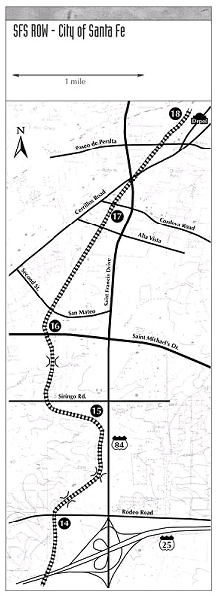
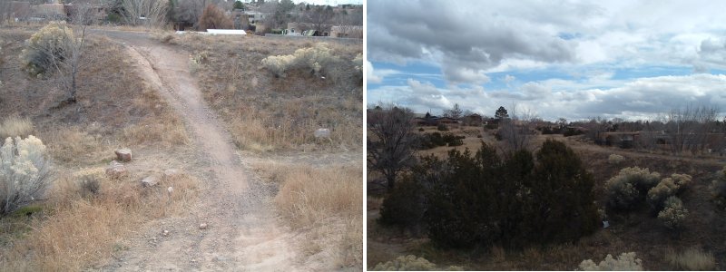
Walking the Santa Fe Southernby LeftyI wanted to walk along the right of way of the Santa Fe Southern Railway, so on November 27 2006, I got my chance.The famous Atchison, Topeka, and Santa Fe Railroad originally by passed the city of Santa Fe itself, but in the 1880's, a spur some 18 miles long was built from the little town of Lamy, south of the city, where the main line made its closest approach. Today, the main line is called the BN&SF and the spur from Lamy to Santa Fe belongs to a short line railroad called the Santa Fe Southern. The Santa Fe Southern carries freight and runs a daily excursion train during the summer months from Santa Fe to Lamy and back. I began my walk at 715 Gildersleeve and went along Paseo de Peralta to Guadalupe and from there down to the train station. Before starting my walk, I decided to put fresh batteries in my camera so I spent a few minutes wandering up and down Guadalupe trying to find a place that sold AA batteries. By the time I found my batteries, it was just after 11:00 a.m, and Tomasitas restaurant was open. It seemed like a good idea to have a bite before setting out, since I expected to be walking for several hours. After a bowl of Tortilla soup and a visit to the men's room, I felt ready to begin my odessey. The map to the right shows the route I followed from milepost 18 at the depot to milepost 14 just past Rodeo Road. The route slopes up a slight grade from the station to a point near San Mateo road, then drops rapidly into a hollow laced with dry creek beds. The right of way is frequented by joggers, some carrying little plastic bottles of water. At one point I was slogging along the cinder trail next to the track when I heard a rhythmic crunch of feet behind me and moved to the right to clear the trail for the over taking jogger. A sweet voice piped: "Thank you!" as she danced by me, her ponytail bobbing up and down.
There were a number of delapidated passenger cars parked near the station as well as two diesel locomotives. One of the locomotives appeared to be almost new and had no railroad markings on it at all. The other locomotive was one I had seen before on visits to Santa Fe and clearly showed its age.
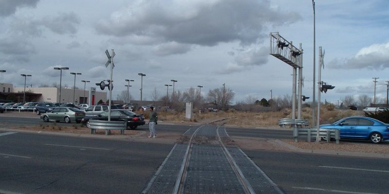
My first real challenge was following the tracks across the intersection of St. Francis Drive and Cerrilos road. I had to detour through a complex network of pedestrian cross walks to get from the north side of the intersection to the point where the tracks lead south.
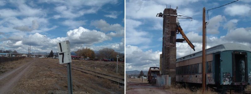
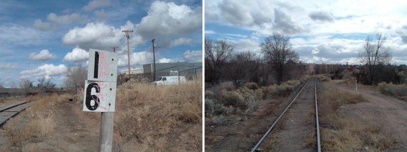
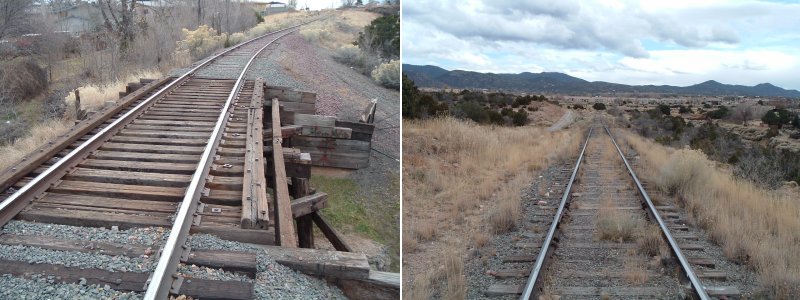
Just past Cordova I came to mile post 17, which meant that I had travelled one mile from the station. The photograph shows the view along the tracks north toward the station. The traffic in the distance was moving along Cordova road. It was just about noon, but the sunny skies were beginning to fill with thickening clouds that grew grayer during the day. A major cold front was a day and a half away at the time. A little further along I came upon an ancient service tower whose function I could not discern. Perhaps it was once a watering tower for steam locomotives; in any case it was no longer used and the track in front of the tower was occuppied by an old passenger car sitting on blocks. Nearby was a sign bearing a warning I saw repeated often along the right away: "Structures along track will not clear man on side of car."
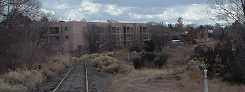
Pushing south from the old service tower to San Mateo road, I came to milepost 16, indicating I was now two miles out from the depot. Although I was still inside the city limits, there were fewer buildings and structures along the track now. I passed a group of hoboes sitting in a deep, dry ditch beside the track. I considered taking a picture of them, but decided against it. Some people don't like having their pictures taken. Soon I came to the first of several trestles along the route. This picture (right) shows the view down the tracks as I came in sight of the trestle, which is just around a bend to the right. The trail beside the tracks led down through the dry creek bed, but since this was a very short trestle, I decided to walk across it.
I was surprised how insecure I felt stepping from one crosstie to the next and looking down at the sandy bed of the dry creek, some twenty feet below.
When I reached the spot where the tracks crossed St. Michaels Drive, there was no nearby crosswalk, so I had to wait for a gap in the traffic and dart halfway across, then wait for another gap to finish the cross. I stopped to shoot a picture of the track behind me and happened to catch a jogger trying to negotiate the same crossing.
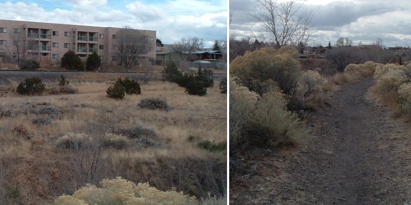
Farther along, I was following a jogging trail that paralleled the track, which was on a high embankment. The trail started to veer away from the railroad tracks as it followed the bank of another dry creek bed and the bank of the creek was rather high and steep, so I elected to follow the jogging trail in hopes of finding my way back to the railroad tracks eventually.
Sure enough, the trail led down into the creek bed and up the other bank. On the other side of the creek, the jogging trail led back toward the tracks. I was looking for the next mile post. I thought that when I got to 15, I should start back, but I did not see it when I expected to. I pressed, hoping to find a milepost to document my distance walked before my time ran out. I told myself to limit my walk along the track to as far as I could go in two hours.
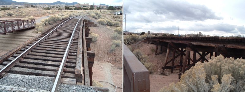
Another trestle to cross, then a little farther on the tracks descended down the south side of a tall hill. I continued onward, still looking for another milepost and checking my watch frequently to see how much time I had left. I had left the depot about 11:45 and it was now about 1:30. By 1:45, I wanted to be headed back to the house.
Another trestle, the third of the day and the longest I had encountered. To the left of the track was a paved jogging trail and a footbridge spanned the dry creek. There were a couple of railroad guys working not far ahead, clearing the sagebrush from alongside the track. I noticed a little sign on the trestle with the number "14.2" and I speculated this might be the mile position of the trestle along the track. If that was the case, then I was only two-tenths of a mile from milepost 14. Encouraged, I pressed on, but 0.2 miles appeared to be farther than I would have thought. Beyond the trestle, beyond the work crew, the track stretched ahead right up to Rodeo Road.
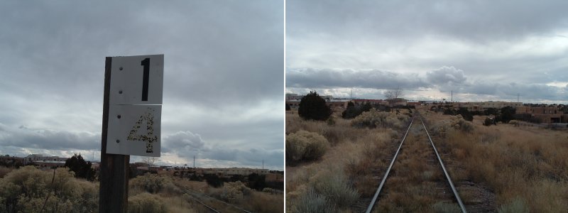
Not long after crossing Rodeo Road, I found what I was looking for, milepost 14. After photograping the milepost sign, I took a shot of the track leading south through the sagebrush. Goodbye to Santa Fe Southern, it is time to go back to the house.
Lefty
|
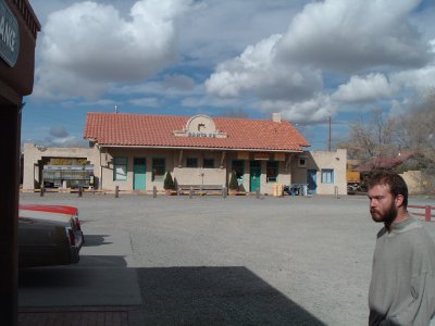 I took this picture of the Depot at Santa Fe while standing in front of Tomasitas restaurant, just as the first diners began to arrive and mill about waiting for the doors to open. What you see is actually the rear of the depot, the tracks are on the other side. In the little depot office, you can make reservations for the excursion train and buy little railroad souveniers. One thing they do not have in there is AA batteries, or any other kind of batteries.
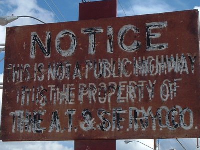 Just south of the station, the tracks cross Paseo de Peralta and there I found this ancient sign with its stern warning. I was not deterred since the AT&SF railroad no longer exists and it's successor company does not own the right of way. It looked as if the attempts to reletter the sign over the years had only made it harder to read and did nothing to add to its credibility.
 I returned via St. Francis Road to save time. It took about an hour and fifteen minutes to get back to Gildersleeve. My total trip time, from the time I left the house was five hours. My feet hurt and my legs were sore, but I felt great.